 Catalogue PIGMA
D1: Biodiversity
Type of resources
Available actions
Topics
Keywords
Contact for the resource
Provided by
Representation types
Update frequencies
status
Scale
-
-
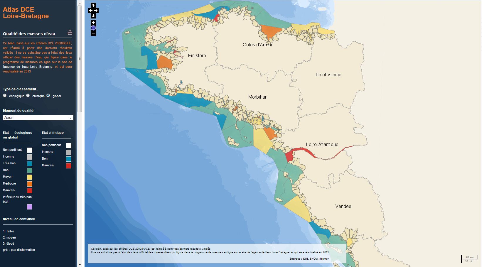
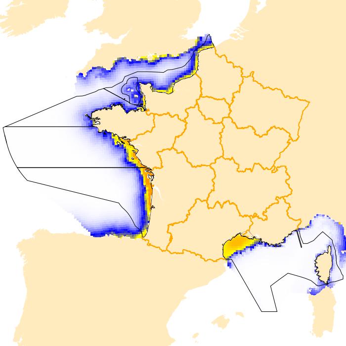
The analysis concerns the assessment of the overall state of the coastal and transitional waters of the Western Channel and the Bay of Biscay. It results from the combination of the ecological status and the chemical status of each water body according to the rules of the European Water Framework Directive (WFD). The most recent assessment of the state is presented in the DCE Loire-Bretagne atlas. Earlier reports are available in annual archives.
-
The inventory of national marine habitats in mainland France was undertaken at the request of the Ministry for Sustainable Development. Its primary objective is to meet local requirements with regards to designation of sites of ecological importance which are joining the European Natura 2000 Network as part of the “Habitat, fauna, flora” directive (DHFF) from 1992.
-
The aim of this project is to develop an eco-physiological model to predict production flow of certain species of planktonic Foraminifera, which are representative of the main ecological system, as well as their habitat (depth, season), from climate forcing. The eco-physiological and geochemical/isotopic characteristics must be determined by the data obtained during cruises. The data from closing nets and sediment traps will be used to evaluate flows from different Foraminifera and the acquisition of their isotope and geochemical signals according to the depth of their habitat and their development cycle. The project is linked to ANR FORCLIM (coordinator L.Labeyrie, LSCE). Data is organised into two parts : 1/ measurements of physiochemical and biogeochemical parameters in the water column ; inventory of planktonic Foraminifera - 2/ Measurements of biogeochemical parameters and the interface between sediment and water: inventory of benthic Foraminifera fauna. The campaign is connected to the STEEPL Observation Service (Temporal monitoring of benthic and planktonic ecosystems in the Landes plateau) – OSUNA funding (Nantes Angers Sciences of the Universe Observatory).
-
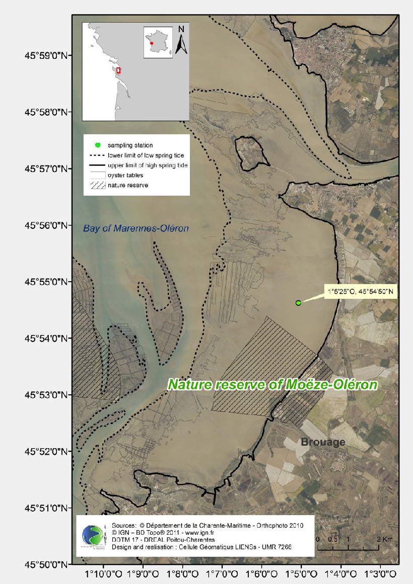
Zooplankton monitoring (essentially metazoal) – mesozooplankton in the Gironde estuary (3 stations) since 1997 Locations : 3 Stations pK86 : 45°31’N, 01°57’W, pK52 : 45°14’80’’N, 0°43’50’’W pK30 : 45°04’10’’N, 0°38’30’’W
-
To produce marine bird indicators of the ecological state of the French coasts (functioning, Marine protected Areas, etc.) To structure monitoring works carried out on the French coasts as a network To extend the sectors involved to all coasts, beyond the borders of the Interreg Atlantic Arc (project for 2013) To study the distribution of marine birds along French coasts To identify functional sites To identify areas of high concentration and, in other cases, marine Important Bird Areas To list the currents Marine Protected Areas (N2000 en mer, Marine parks, Nature reserves)
-

-
Intertidal mudflats are a key system of the network, being closely connected to ecosystems which form the transition between the watershed area and the ocean. Their high productivity is linked to activity within a diatom biofilm, the functioning and future of which have recently been the subject of many research programmes. However, the determinism and future of bacterial production associated with the secretion of ExoPolySaccharides within the biofilm is largely unknown. Early studies have nevertheless shown that this production is at least as high as that of diatoms. An integrated view of the ecological functioning of intertidal mudflats within a more global schema of carbon flow therefore needs to define and quantify the determinism of this bacterial production and it future within the ecosystem.
-
-
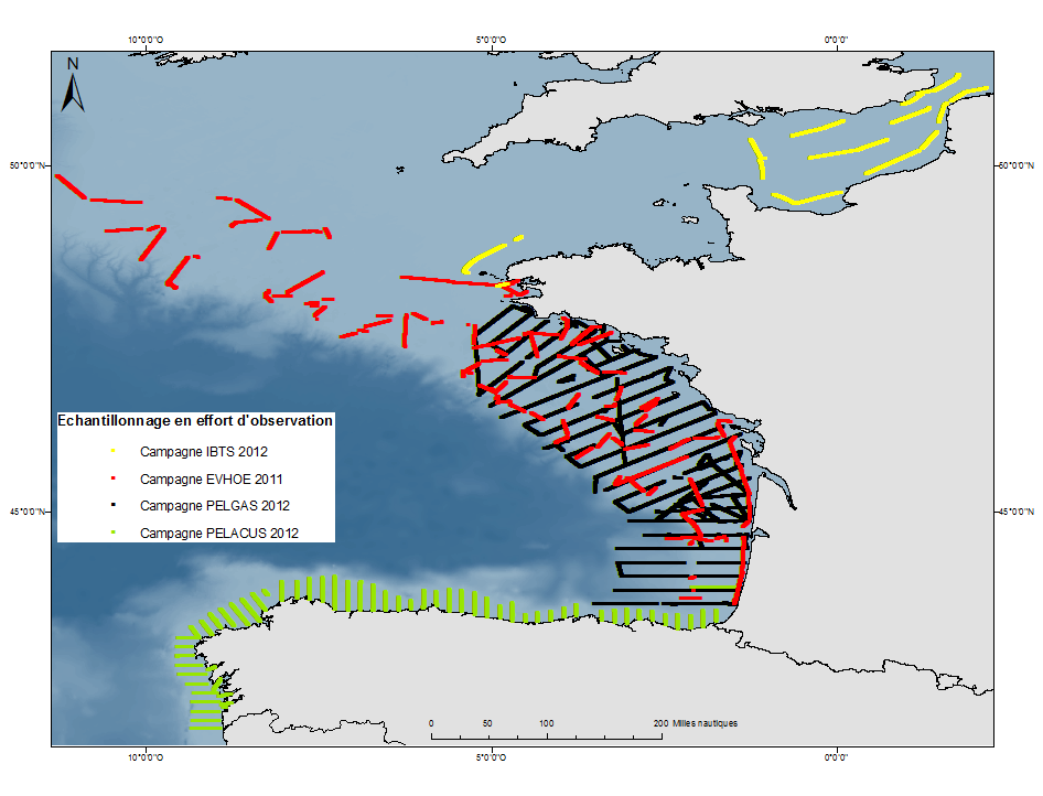
The aim of these measures is to monitor the relative distribution and abundance of cetaceans and marine birds from Ifremer/IEO fisheries campaigns on board the Thalassa oceanographic vessel. These measures are also used to determine these predators’ favourite habitats thanks to the ecosystem approach of the campaigns (distribution and abundance of pelagic fish, plankton and physical parameters).